Miller Creek Bridges
 Following the June 2012 record-breaking regional floods, all of the Miller Creek at LSC monitoring equipment was lost. Additionally, two foot bridges crossing Miller Creek were destroyed and floated downstream.
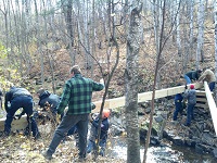
Thanks to LSC’s Emergency Response Trailing Center (ERTC) student volunteers, Sustainability Council members, and the expertise of Larry Sampson of the Superior Hiking Trail Association, the two LSC Interpretive Trail foot bridges were replaced. 
Monitoring equipment was replaced in 2014, and stream data can be found at duluthstreams.org. The upper bridge was re-located to a site slightly upstream from the original location. The new trail map, created by Civil Tech student Rene Fall, includes the half-mile loop path and can be found here.
Posted in: Good Stuff
Leave a Comment (0) ↓